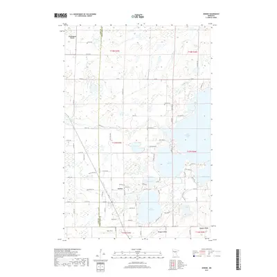
2019 Map of Jenkins
USGS Topo · Published 2019About this map
Jenkins and Chickamaw Beach anchor this transition between the prairie and the deep lakes of north-central Minnesota. The landscape is defined by its massive water bodies, most notably Upper Hay Lake and its connection to Lower Hay Lake, as well as the northern reaches of Pequot Lakes. The hydrological network is dense, with Arvig Creek and the Pine River winding through the terrain toward the massive expanse of Upper Whitefish Lake.
Find a feature on this map
87 named features on this map. Tap any name to fly to it.
Don’t see what you’re looking for? This feature index may not catch every label — zoom into the map to look around manually.
Map Details
Editions of this 2019 Jenkins Map
This is the sole edition of this map. No revisions or reprints were ever made.
Other maps of this area

1953 · Brainerd
USGS Topo · 1:250,000

1957 · Brainerd
USGS Topo · 1:250,000

1958 · Brainerd
USGS Topo · 1:250,000

1959 · Pelican Lake
USGS Topo · 1:24,000

1959 · Nisswa
USGS Topo · 1:24,000

1959 · Lower Whitefish Lake
USGS Topo · 1:24,000

1959 · Pine River
USGS Topo · 1:24,000

1959 · Jenkins
USGS Topo · 1:24,000

1959 · Pine River SW
USGS Topo · 1:24,000

1965 · Brainerd
USGS Topo · 1:250,000