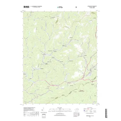
2019 Map of Jenkins West
USGS Topo · Published 2019About this map
McRoberts and Fleming-Neon anchor a dense network of coal-country settlements along the steep hollows of Letcher County. The landscape is defined by the sharp ridges of Pine Mountain and Cumberland Mountain, with the C and O Railroad threading through the valley to serve the industrial and residential hubs of Jenkins and McRoberts. Local history is deeply etched into the terrain at sites like Bandmill Bottom and Tolliver Town, while the higher elevations are marked by landmarks such as Gamblers Rock and the passage at Pound Gap. The southeastern portion of the map transitions into the Jefferson National Forest, where the border between Kentucky and Virginia follows the high ridgelines. Numerous small communities like Seco, Kona, and Cromona illustrate the concentrated settlement patterns necessitated by the narrow valley floors of the Cumberland Plateau.
Find a feature on this map
150 named features on this map. Tap any name to fly to it.
Don’t see what you’re looking for? This feature index may not catch every label — zoom into the map to look around manually.
Map Details
Editions of this 2019 Jenkins West Map
This is the sole edition of this map. No revisions or reprints were ever made.
Other maps of this area

1890 · Whitesburg
USGS Topo · 1:125,000

1892 · Whitesburg
USGS Topo · 1:125,000

1912 · Pound
USGS Topo · 1:48,000

1912 · Hindman
USGS Topo · 1:48,000

1913 · Oven Fork
USGS Topo · 1:48,000

1914 · Pound
USGS Topo · 1:62,500

1914 · Vergie
USGS Topo · 1:48,000

1915 · Hindman
USGS Topo · 1:62,500

1915 · Whitesburg
USGS Topo · 1:62,500

1916 · Pikeville
USGS Topo · 1:62,500