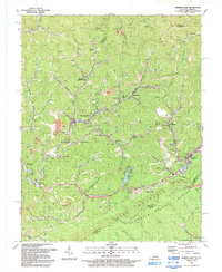
1992 Map of Jenkins West
USGS Topo · Published 1992About this map
The Kentucky River begins its long journey through the Appalachians here, its headwaters winding past coal-rich slopes and narrow hollows. This 1990s record of Letcher County highlights the dense network of mining settlements that define the region's character, including Hemphill (Jackhorn PO), McRoberts, and Fleming-Neon. The landscape is physically dominated by the steep rise of Pine Mountain, which forms a natural barrier between Kentucky and Virginia, protected in part by the Jefferson National Forest.
Find a feature on this map
76 named features on this map. Tap any name to fly to it.
Don’t see what you’re looking for? This feature index may not catch every label — zoom into the map to look around manually.
Map Details
Editions of this 1992 Jenkins West Map
This is the sole edition of this map. No revisions or reprints were ever made.
Other maps of this area

1890 · Whitesburg
USGS Topo · 1:125,000

1892 · Whitesburg
USGS Topo · 1:125,000

1912 · Pound
USGS Topo · 1:48,000

1912 · Hindman
USGS Topo · 1:48,000

1913 · Oven Fork
USGS Topo · 1:48,000

1914 · Pound
USGS Topo · 1:62,500

1914 · Vergie
USGS Topo · 1:48,000

1915 · Hindman
USGS Topo · 1:62,500

1915 · Whitesburg
USGS Topo · 1:62,500

1916 · Pikeville
USGS Topo · 1:62,500