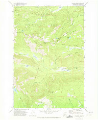
1970 Map of Jennies Butte
USGS Topo · Published 1974About this map
The Goat Rocks Wilderness and Snoqualmie National Forest dominate this high-elevation landscape, where the headwaters of several major river systems diverge. The topographic detail captures the rugged transition across the Klickitat Divide, where water flows toward the Tieton River in the north and the Klickitat River to the south. Historically significant surveyed borders define the terrain, most notably the Yakima Indian Reservation Boundary and the Campbell Line (1906-07), which represent the complex history of land division in central Washington.
Find a feature on this map
47 named features on this map. Tap any name to fly to it.
Don’t see what you’re looking for? This feature index may not catch every label — zoom into the map to look around manually.
Map Details
Editions of this 1970 Jennies Butte Map
2 editions found
Other maps of this area

1902 · Mount Aix
USGS Topo · 1:125,000

1904 · Mt Aix
USGS Topo · 1:125,000

1904 · Mount Adams
USGS Topo · 1:125,000

1907 · Mount Adams
USGS Topo · 1:125,000

1950 · Yakima
USGS Topo · 1:250,000

1958 · Yakima
USGS Topo · 1:250,000

1961 · Yakima
USGS Topo · 1:250,000

1962 · White Pass
USGS Topo · 1:62,500

1967 · Darland Mtn
USGS Topo · 1:24,000
1969 · Castile Falls
USGS Topo · 1:24,000