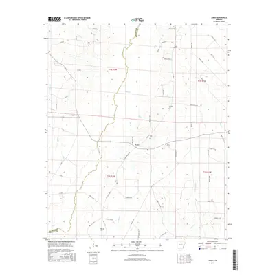
2017 Map of Jersey
USGS Topo · Published 2017About this map
The settlement of Jersey serves as the central hub of this Bradley County landscape, situated near the headwaters of Mill Br and Mud Springs. The area's geography is defined by the winding course of Moro Cr, which marks the boundary with Calhoun County to the west. This drainage system, including tributaries like Dunn Cr, Jolly Cr, and Villum Br, creates a low-lying terrain characterized by Pin Oak Flat in the southwest.
Find a feature on this map
72 named features on this map. Tap any name to fly to it.
Don’t see what you’re looking for? This feature index may not catch every label — zoom into the map to look around manually.
Map Details
Editions of this 2017 Jersey Map
This is the sole edition of this map. No revisions or reprints were ever made.
Other maps of this area

1934 · Ingalls
USGS Topo · 1:48,000

1934 · Moro Bay
USGS Topo · 1:62,500

1937 · Ingalls
USGS Topo · 1:62,500

1938 · Moro Bay
USGS Topo · 1:62,500

1939 · Moro Bay
USGS Topo · 1:62,500

1939 · Ingalls
USGS Topo · 1:62,500

1953 · El Dorado
USGS Topo · 1:250,000

1957 · El Dorado
USGS Topo · 1:250,000

1958 · El Dorado
USGS Topo · 1:250,000

1960 · El Dorado
USGS Topo · 1:250,000