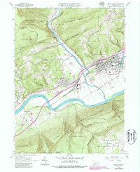
1965 Map of Jersey Shore
USGS Topo · Published 1986About this map
The West Branch Susquehanna River and its confluence with Pine Creek define the central geography of this central Pennsylvania landscape. In the mid-1960s, the borough of Jersey Shore stands as a primary hub, showing a dense grid of streets and the extensive Jersey Shore Cemetery. South of the river, the town of McElhattan is positioned near the base of Bald Eagle Mountain, while the northern portion of the sheet is dominated by the steep terrain of Short Mountain and the Tiadaghton State Forest.
Find a feature on this map
61 named features on this map. Tap any name to fly to it.
Don’t see what you’re looking for? This feature index may not catch every label — zoom into the map to look around manually.
Map Details
Editions of this 1965 Jersey Shore Map
4 editions found
Other maps of this area

1921 · Williamsport
USGS Topo · 1:48,000

1921 · Trout Run
USGS Topo · 1:62,500

1921 · Lock Haven
USGS Topo · 1:62,500

1923 · Lock Haven
USGS Topo · 1:62,500

1923 · Trout Run
USGS Topo · 1:62,500

1923 · Williamsport
USGS Topo · 1:62,500

1935 · Waterville
USGS Topo · 1:24,000

1937 · Waterville
USGS Topo · 1:48,000

1943 · Waterville
USGS Topo · 1:62,500

1944 · Trout Run
USGS Topo · 1:62,500