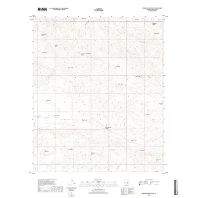
2018 Map of Jerusalem Mountain
USGS Topo · Published 2018About this map
Jerusalem Mtn and Huggins Peak anchor this Pinal County landscape, where deep drainages like Rattlesnake Canyon and Devils Canyon carve through the high terrain. The map details a complex network of canyons and basins, including Granite Basin and Reed Basin, which reflect the geological diversity of the region. Water sources, vital in this arid environment, are marked at Rockhouse Spring, Lime Spring, and Walker Springs.
Find a feature on this map
37 named features on this map. Tap any name to fly to it.
Don’t see what you’re looking for? This feature index may not catch every label — zoom into the map to look around manually.
Map Details
Editions of this 2018 Jerusalem Mountain Map
This is the sole edition of this map. No revisions or reprints were ever made.
Other maps of this area

1911 · Winkelman
USGS Topo · 1:125,000

1913 · Winkelman
USGS Topo · 1:125,000

1915 · Christmas
USGS Topo · 1:62,500

1917 · Christmas
USGS Topo · 1:62,500

1938 · Klondyke
USGS Topo · 1:48,000

1943 · Klondyke
USGS Topo · 1:62,500

1949 · Holy Joe Peak
USGS Topo · 1:62,500

1949 · Saddle Mtn.
USGS Topo · 1:24,000

1949 · Brandenburg Mtn
USGS Topo · 1:24,000
1950 · Saddle Mtn.
USGS Topo · 1:24,000