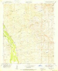
1950 Map of Saddle Mtn.
USGS Topo · Published 1950About this map
The San Pedro River corridor defines the western edge of this 1950 survey, providing a fertile contrast to the arid drainage basins of the Gila River Valley. This desert landscape is marked by the presence of historical ranching and early education, notably at Eskiminzin Ranch and the Finch Sch (Aban'd). The topographic detail reveals a network of ephemeral watercourses like Eskiminzin Wash and Lantern Wash that cut through the high ground of Saddle Mtn and Malpais Hill.
Find a feature on this map
28 named features on this map. Tap any name to fly to it.
Don’t see what you’re looking for? This feature index may not catch every label — zoom into the map to look around manually.
Map Details
Editions of this 1950 Saddle Mtn. Map
This is the sole edition of this map. No revisions or reprints were ever made.
Other maps of this area

1910 · Ray
USGS Topo · 1:62,500

1911 · Winkelman
USGS Topo · 1:125,000

1913 · Winkelman
USGS Topo · 1:125,000

1915 · Christmas
USGS Topo · 1:62,500

1917 · Christmas
USGS Topo · 1:62,500

1949 · Holy Joe Peak
USGS Topo · 1:62,500

1949 · Winkelman
USGS Topo · 1:24,000

1949 · Winkelman
USGS Topo · 1:62,500

1949 · Saddle Mtn.
USGS Topo · 1:24,000

1949 · Brandenburg Mtn
USGS Topo · 1:24,000