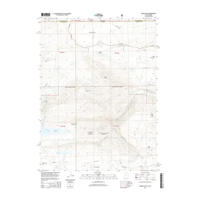
2014 Map of Jessen Butte
USGS Topo · Published 2014About this map
Ashley National Forest dominates the southern landscape of this terrain where the Wyoming and Utah borders meet. The geography is defined by complex water management and high-elevation landforms, including the prominent Jessen Butte and the deep incisions of Sols Canyon. Agricultural and conservation interests are evident through the extensive reach of the S Valley Canal and Lodgepole Canal, which draw from local waterways like Lodgepole Creek and Sheep Creek. The presence of the Sheep Creek Canyon Geological Area highlights the unique stratigraphy of the region, while the lonely site of Dowds Grave offers a specific point of interest for those tracing local frontier history. Further south, recreational and irrigation resources such as Long Park Reservoir and Sheep Creek Lake sit amidst high parks like Half Moon Park, illustrating a landscape utilized for both resource extraction and public land management at the start of the twenty-first century.
Find a feature on this map
50 named features on this map. Tap any name to fly to it.
Don’t see what you’re looking for? This feature index may not catch every label — zoom into the map to look around manually.
Map Details
Editions of this 2014 Jessen Butte Map
This is the sole edition of this map. No revisions or reprints were ever made.
Other maps of this area

1885 · Ashley
USGS Topo · 1:250,000

1906 · Marsh Peak
USGS Topo · 1:125,000

1908 · Marsh Peak
USGS Topo · 1:125,000

1954 · Vernal
USGS Topo · 1:250,000

1954 · Rock Springs
USGS Topo · 1:250,000

1958 · Vernal
USGS Topo · 1:250,000

1958 · Rock Springs
USGS Topo · 1:250,000

1960 · Vernal
USGS Topo · 1:250,000

1962 · Rock Springs
USGS Topo · 1:250,000
1963 · Whiterocks Lake
USGS Topo · 1:24,000