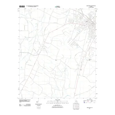
2011 Map of Jesup West
USGS Topo · Published 2011About this map
Jesup serves as the primary urban center for this corner of Wayne County, showing a detailed street grid and the Jesup Post Office. This modern survey documents the expansion of residential and industrial corridors south and west from the city center, reaching out toward smaller settlements like Slover and Leake. The landscape is defined by the drainage patterns of several tributaries, including Little Satilla Creek in the northwest and Walker Creek running through the central region. To the southeast, the Jesup-Wayne County Airport is a prominent landmark adjacent to Club Dr. The road network preserves several historically significant local routes, such as Satilla Church Rd and Flint Branch Church Rd, which reference local congregations, while Old Screven Rd suggests the primary corridor connecting toward the neighboring county. This map reflects the contemporary balance between agricultural land, wetlands along Little Penholoway Creek, and suburban development.
Find a feature on this map
45 named features on this map. Tap any name to fly to it.
Don’t see what you’re looking for? This feature index may not catch every label — zoom into the map to look around manually.
Map Details
Editions of this 2011 Jesup West Map
This is the sole edition of this map. No revisions or reprints were ever made.
Other maps of this area

1918 · Jesup
USGS Topo · 1:62,500

1918 · Hortense
USGS Topo · 1:62,500

1943 · Jesup
USGS Topo · 1:62,500

1944 · Hortense
USGS Topo · 1:62,500

1946 · Brunswick
USGS Topo · 1:250,000

1948 · Brunswick
USGS Topo · 1:250,000

1953 · Waycross
USGS Topo · 1:250,000

1956 · Brunswick
USGS Topo · 1:250,000

1958 · Waycross
USGS Topo · 1:250,000

1961 · Brunswick
USGS Topo · 1:250,000