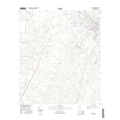
2017 Map of Jesup West
USGS Topo · Published 2017About this map
Jesup serves as the primary urban center on this Wayne County landscape, where the grid of city streets gives way to the wetlands and bays of the coastal plain. The terrain is defined by low-lying drainages including Little Satilla Cr and Walker Creek, alongside significant depression wetlands known locally as bays, such as Millikin Bay and Mosely Bay. The rural infrastructure is anchored by the Jesup-Wayne County Airport and the small settlement of Slover to the south. Local transit and history are reflected in thoroughfares like Holmesville Rd and Flint Branch Church Rd, while Dobson Mill Br suggests the legacy of early timber or milling operations that once utilized these slow-moving blackwater streams. This map documents the intersection of modern aviation and residential growth with the persistent, water-heavy geography of Southeast Georgia.
Find a feature on this map
132 named features on this map. Tap any name to fly to it.
Don’t see what you’re looking for? This feature index may not catch every label — zoom into the map to look around manually.
Map Details
Editions of this 2017 Jesup West Map
This is the sole edition of this map. No revisions or reprints were ever made.
Other maps of this area

1918 · Jesup
USGS Topo · 1:62,500

1918 · Hortense
USGS Topo · 1:62,500

1943 · Jesup
USGS Topo · 1:62,500

1944 · Hortense
USGS Topo · 1:62,500

1946 · Brunswick
USGS Topo · 1:250,000

1948 · Brunswick
USGS Topo · 1:250,000

1953 · Waycross
USGS Topo · 1:250,000

1956 · Brunswick
USGS Topo · 1:250,000

1958 · Waycross
USGS Topo · 1:250,000

1961 · Brunswick
USGS Topo · 1:250,000