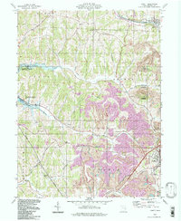
1994 Map of Jewett
USGS Topo · Published 1998About this map
The rugged topography of Harrison County is extensively marked by the heavy industrial footprint of Strip Mines and the State Mine across this landscape. Stretching from the village of Jewett southwest toward the reservoir at Tappan Lake, the terrain shows a mix of coal extraction and conservation efforts within the Harrison State Forest and the Muskingum Watershed Conservancy District.
Find a feature on this map
37 named features on this map. Tap any name to fly to it.
Don’t see what you’re looking for? This feature index may not catch every label — zoom into the map to look around manually.
Map Details
Editions of this 1994 Jewett Map
This is the sole edition of this map. No revisions or reprints were ever made.
Other maps of this area

1901 · Cadiz
USGS Topo · 1:62,500

1902 · Scio
USGS Topo · 1:62,500

1903 · Cadiz
USGS Topo · 1:62,500

1903 · Flushing
USGS Topo · 1:62,500

1904 · Scio
USGS Topo · 1:62,500

1905 · St. Clairsville
USGS Topo · 1:62,500

1905 · Flushing
USGS Topo · 1:62,500

1951 · Canton
USGS Topo · 1:250,000

1953 · Canton
USGS Topo · 1:250,000

1957 · Canton
USGS Topo · 1:250,000