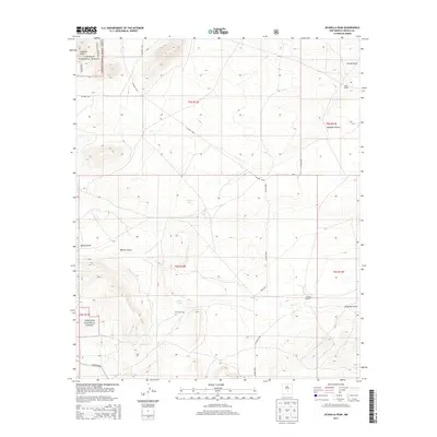
2013 Map of Jicarilla Peak
USGS Topo · Published 2013About this map
Jicarilla Peak dominates the high-altitude landscape of northern Lincoln County, where the northern boundaries of the Lincoln National Forest meet a series of ephemeral basins and drainages. The area is defined by its transition from peak to basin, where seasonal water flows from high points into Patos Lake and Lavade Lake. Local history and family genealogy center on ranching and early settlement, marked by the presence of Patos Cem near the banks of Patos Cr. Private holdings like Davis Ranch and Eldridge Ranch are connected by a network of rural county roads, including Co Road A036 and Bogle Rd, illustrating the modern management of these traditional ranching lands. This landscape remains largely defined by its natural topography, from the steep descents of Warner Gulch to the broad drainage of Reventon Draw.
Find a feature on this map
26 named features on this map. Tap any name to fly to it.
Don’t see what you’re looking for? This feature index may not catch every label — zoom into the map to look around manually.
Map Details
Editions of this 2013 Jicarilla Peak Map
This is the sole edition of this map. No revisions or reprints were ever made.
Other maps of this area

1934 · Capitan
USGS Topo · 1:48,000

1935 · Capitan Mountains
USGS Topo · 1:48,000

1937 · Capitan
USGS Topo · 1:62,500

1940 · Capitan Mountains
USGS Topo · 1:62,500

1955 · Roswell
USGS Topo · 1:250,000

1958 · Roswell
USGS Topo · 1:250,000

1962 · Roswell
USGS Topo · 1:250,000

1973 · Ancho
USGS Topo · 1:24,000

1973 · Jacob Spring
USGS Topo · 1:24,000

1973 · Chupadero Mountain
USGS Topo · 1:24,000