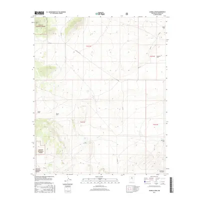
2017 Map of Jicarilla Peak
USGS Topo · Published 2017About this map
Jicarilla Peak anchors the high northwestern reaches of this terrain in Lincoln County, where the northernmost edges of the Sacramento Mountains transition into the drainages of the high desert. Much of the western landscape is protected within the Lincoln National Forest, while the central and eastern sections are defined by wide ranch lands and a complex network of ephemeral waterways. The presence of the Patos Cem near Patos Lake points to a history of settlement tied to these intermittent water sources. Topographic features such as Lavade Draw and Hogadero Draw illustrate the natural drainage patterns that have shaped land use and road placement, including routes like Bogle Rd and Patos Rd. The interior of the quadrangle is largely defined by open country, including the Grande Vista Ranch, reflecting the region's enduring ranching economy.
Find a feature on this map
23 named features on this map. Tap any name to fly to it.
Don’t see what you’re looking for? This feature index may not catch every label — zoom into the map to look around manually.
Map Details
Editions of this 2017 Jicarilla Peak Map
This is the sole edition of this map. No revisions or reprints were ever made.
Other maps of this area

1934 · Capitan
USGS Topo · 1:48,000

1935 · Capitan Mountains
USGS Topo · 1:48,000

1937 · Capitan
USGS Topo · 1:62,500

1940 · Capitan Mountains
USGS Topo · 1:62,500

1955 · Roswell
USGS Topo · 1:250,000

1958 · Roswell
USGS Topo · 1:250,000

1962 · Roswell
USGS Topo · 1:250,000

1973 · Ancho
USGS Topo · 1:24,000

1973 · Jacob Spring
USGS Topo · 1:24,000

1973 · Chupadero Mountain
USGS Topo · 1:24,000