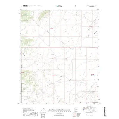
2023 Map of Jicarilla Peak
USGS Topo · Published 2023About this map
Jicarilla Peak anchors this high-elevation landscape in Lincoln County, where the northern reaches of the Sacramento Mountains meet the vast drainage systems of the eastern plains. Much of the western terrain is protected within the Lincoln National Forest, a territory defined by sharp topographic relief and rugged canyons like Warner Gulch and Spring Gulch. These features descend into more open ranching country to the east, marked by the long paths of Lavade Draw and Reventon Draw. Evidence of early settlement and land use is sparse but significant, centered around the Patos Creek corridor. Here, researchers can locate the Patos Cem and Patos Lake, situated near cattle-country infrastructure like the Grande Vista Ranch. The map illustrates a modern landscape where historical ranch roads such as Bogle Rd and Patos Rd continue to provide access to these isolated peaks and seasonal water sources like Lavade Lake.
Find a feature on this map
23 named features on this map. Tap any name to fly to it.
Don’t see what you’re looking for? This feature index may not catch every label — zoom into the map to look around manually.
Map Details
Editions of this 2023 Jicarilla Peak Map
This is the sole edition of this map. No revisions or reprints were ever made.
Other maps of this area

1934 · Capitan
USGS Topo · 1:48,000

1935 · Capitan Mountains
USGS Topo · 1:48,000

1937 · Capitan
USGS Topo · 1:62,500

1940 · Capitan Mountains
USGS Topo · 1:62,500

1955 · Roswell
USGS Topo · 1:250,000

1958 · Roswell
USGS Topo · 1:250,000

1962 · Roswell
USGS Topo · 1:250,000

1973 · Ancho
USGS Topo · 1:24,000

1973 · Jacob Spring
USGS Topo · 1:24,000

1973 · Chupadero Mountain
USGS Topo · 1:24,000