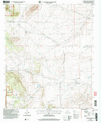
2004 Map of Jicarilla Peak
USGS Topo · Published 2006About this map
Jicarilla Peak dominates the northwestern heights of this Lincoln National Forest landscape, where the high-altitude terrain gives way to a network of seasonal draws and ranchlands. The area's history is preserved in small, isolated markers of settlement, most notably the Patos Cem located near the banks of Patos Creek. The map reveals a land managed for both conservation and livestock, with the Davis Ranch and Eldridge Ranch appearing as central points of activity in the lower elevations.
Find a feature on this map
21 named features on this map. Tap any name to fly to it.
Don’t see what you’re looking for? This feature index may not catch every label — zoom into the map to look around manually.
Map Details
Editions of this 2004 Jicarilla Peak Map
This is the sole edition of this map. No revisions or reprints were ever made.
Other maps of this area

1934 · Capitan
USGS Topo · 1:48,000

1935 · Capitan Mountains
USGS Topo · 1:48,000

1937 · Capitan
USGS Topo · 1:62,500

1940 · Capitan Mountains
USGS Topo · 1:62,500

1955 · Roswell
USGS Topo · 1:250,000

1958 · Roswell
USGS Topo · 1:250,000

1962 · Roswell
USGS Topo · 1:250,000

1973 · Ancho
USGS Topo · 1:24,000

1973 · Jacob Spring
USGS Topo · 1:24,000

1973 · Chupadero Mountain
USGS Topo · 1:24,000