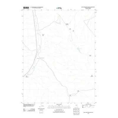
2011 Map of Joe Eason Mountain
USGS Topo · Published 2011About this map
Reese River Valley dominates the western edge of this Nevada landscape, where the Reese River winds northward through a broad basin. This 2011 survey illustrates a sparsely populated ranching corridor defined by a handful of established homesteads, including Vaughn Ranch and Boone Creek Ranch, which sit at the mouths of dry canyons. The terrain transitions from the lowlands of Duffy Meadows to the high ground of Joe Eason Mountain in the southeast. Transportation and water infrastructure are minimal but critical for this environment, evidenced by the Iowa Canyon Ranches Landing Strip and the Iowa Canyon Reservoir. The drainage patterns of Boone Creek and Iowa Creek dictate the placement of local improvements, tracing the routes from the steep walls of Boone Canyon and Picket Canyon toward the central valley floor.
Find a feature on this map
15 named features on this map. Tap any name to fly to it.
Don’t see what you’re looking for? This feature index may not catch every label — zoom into the map to look around manually.
Map Details
Editions of this 2011 Joe Eason Mountain Map
This is the sole edition of this map. No revisions or reprints were ever made.
Other maps of this area

1926 · Roberts Mountains
USGS Topo · 1:250,000

1929 · Roberts Mountains
USGS Topo · 1:250,000

1955 · Millett
USGS Topo · 1:250,000

1956 · Mount Callaghan
USGS Topo · 1:62,500

1956 · Hall Creek
USGS Topo · 1:62,500

1959 · Millett
USGS Topo · 1:250,000

1969 · Manhattan Mtn
USGS Topo · 1:24,000

1969 · Joe Eason Mtn
USGS Topo · 1:24,000
1969 · Manhattan Mtn NW
USGS Topo · 1:24,000

1969 · Vigus Butte NE
USGS Topo · 1:24,000