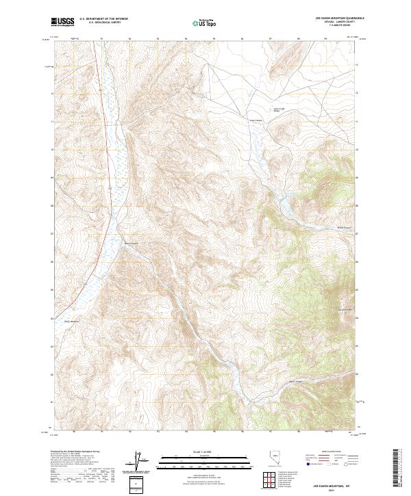
2021 Map of Joe Eason Mountain
USGS Topo · Published 2021About this map
Joe Eason Mtn anchor the high ground in this Lander County landscape, overlooking a series of desert canyons and valleys defined by seasonal drainage patterns. The north-south corridor of the Reese River dominates the western portion of the map, creating a distinct riparian zone that supports Duffy Meadows. This area illustrates the specialized ranching and water management systems required in central Nevada, visible through the presence of the Iowa Canyon Reservoir and the network of creeks flowing from the uplands.
Find a feature on this map
15 named features on this map. Tap any name to fly to it.
Don’t see what you’re looking for? This feature index may not catch every label — zoom into the map to look around manually.
Map Details
Editions of this 2021 Joe Eason Mountain Map
This is the sole edition of this map. No revisions or reprints were ever made.
Other maps of this area

1926 · Roberts Mountains
USGS Topo · 1:250,000

1929 · Roberts Mountains
USGS Topo · 1:250,000

1955 · Millett
USGS Topo · 1:250,000

1956 · Mount Callaghan
USGS Topo · 1:62,500

1956 · Hall Creek
USGS Topo · 1:62,500

1959 · Millett
USGS Topo · 1:250,000

1969 · Manhattan Mtn
USGS Topo · 1:24,000

1969 · Joe Eason Mtn
USGS Topo · 1:24,000
1969 · Manhattan Mtn NW
USGS Topo · 1:24,000

1969 · Vigus Butte NE
USGS Topo · 1:24,000