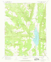
1966 Map of Joes Valley Reservoir
USGS Topo · Published 1968About this map
Joes Valley Reservoir dominates the eastern drainage of this high-elevation landscape within the Manti-La Sal National Forest. Surveyed in the mid-1960s, the map documents a transition between technical infrastructure and traditional ranching life, anchored by the Orange Olsen Administrative Site and the nearby Olsen Ranch. The terrain is defined by dramatic elevation changes, notably visible at The Switchbacks and the White Dugway, which provided passage through the complex system of canyons and benches.
Find a feature on this map
52 named features on this map. Tap any name to fly to it.
Don’t see what you’re looking for? This feature index may not catch every label — zoom into the map to look around manually.
Map Details
Editions of this 1966 Joes Valley Reservoir Map
2 editions found
Other maps of this area

1885 · Manti
USGS Topo · 1:250,000

1895 · Manti
USGS Topo · 1:250,000

1922 · Wasatch
USGS Topo · 1:31,680

1923 · Castle Dale
USGS Topo · 1:62,500

1923 · Hiawatha
USGS Topo · 1:62,500

1925 · Castle Dale
USGS Topo · 1:62,500

1925 · Hiawatha
USGS Topo · 1:62,500

1956 · Price
USGS Topo · 1:250,000

1960 · Price
USGS Topo · 1:250,000

1962 · Price
USGS Topo · 1:250,000