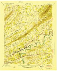
1940 Map of John Sevier
USGS Topo · Published 1940About this map
Holston River currents dominate this 1940 Knox County landscape, flowing past the massive John Sevier Station and the associated John Sevier rail yard. The area is defined by the parallel ridges of Blackoak Ridge and Rogers Ridge, which dictate the placement of early settlements and roads. Institutional landmarks such as the County Hospital and County Workhouse are situated near Maloneyville, while industrial activity is evident at Mascot.
Find a feature on this map
77 named features on this map. Tap any name to fly to it.
Don’t see what you’re looking for? This feature index may not catch every label — zoom into the map to look around manually.
Map Details
Editions of this 1940 John Sevier Map
2 editions found
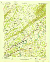
Other maps of this area

1886 · Knoxville
USGS Topo · 1:125,000

1892 · Knoxville
USGS Topo · 1:125,000

1894 · Knoxville
USGS Topo · 1:125,000

1895 · Knoxville
USGS Topo · 1:125,000

1897 · Maynardville
USGS Topo · 1:125,000

1900 · Maynardville
USGS Topo · 1:125,000

1901 · Knoxville
USGS Topo · 1:125,000

1935 · Luttrell
USGS Topo · 1:24,000

1935 · Mascot
USGS Topo · 1:24,000

1935 · Knoxville
USGS Topo · 1:48,000