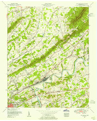
1953 Map of John Sevier
USGS Topo · Published 1955About this map
The Southern Railway dominates the valley landscape of this mid-century survey, specifically at the sprawling rail yards and John Sevier Station along the Holston River. This industrial and transit hub is contrasted by the numerous family and community landmarks found in the surrounding ridges, including the Potters Field Cemetery and the Poor Farm Cemetery near Maloneyville.
Find a feature on this map
90 named features on this map. Tap any name to fly to it.
Don’t see what you’re looking for? This feature index may not catch every label — zoom into the map to look around manually.
Map Details
Editions of this 1953 John Sevier Map
2 editions found
Other maps of this area

1886 · Knoxville
USGS Topo · 1:125,000

1892 · Knoxville
USGS Topo · 1:125,000

1894 · Knoxville
USGS Topo · 1:125,000

1895 · Knoxville
USGS Topo · 1:125,000

1897 · Maynardville
USGS Topo · 1:125,000

1900 · Maynardville
USGS Topo · 1:125,000

1901 · Knoxville
USGS Topo · 1:125,000

1935 · Luttrell
USGS Topo · 1:24,000

1935 · Mascot
USGS Topo · 1:24,000

1935 · Knoxville
USGS Topo · 1:48,000