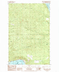
1985 Map of Johnny George Mtn
USGS Topo · Published 1985About this map
The Colville Indian Reservation dominates this 1980s landscape, characterized by the prominent elevation of Johnny George Mtn and the long spine of Whitestone Ridge. The terrain is defined by a series of drainage systems including Sixmile Creek and the bifurcated North Fork and South Fork of the Colville lands. These waters eventually meet the Columbia River, which here forms the expansive Franklin D Roosevelt Lake.
Find a feature on this map
20 named features on this map. Tap any name to fly to it.
Don’t see what you’re looking for? This feature index may not catch every label — zoom into the map to look around manually.
Map Details
Editions of this 1985 Johnny George Mtn Map
This is the sole edition of this map. No revisions or reprints were ever made.
Other maps of this area

1948 · Wilbur
USGS Topo · 1:62,500

1948 · Wilmont Creek
USGS Topo · 1:62,500

1948 · Lincoln
USGS Topo · 1:62,500

1950 · Lincoln
USGS Topo · 1:62,500

1950 · Wilmont Creek
USGS Topo · 1:62,500

1950 · Wilbur
USGS Topo · 1:62,500

1952 · Keller
USGS Topo · 1:62,500

1953 · Ritzville
USGS Topo · 1:250,000

1954 · Okanogan
USGS Topo · 1:250,000

1956 · Wilmont Creek
USGS Topo · 1:62,500