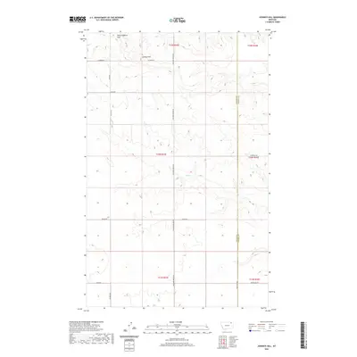
2020 Map of Johnnys Hill
USGS Topo · Published 2020About this map
White Highland Hills and the prominent Johnnys Hill dominate this high plains landscape on the border of Valley and Daniels counties. This terrain is defined by a sparse but organized network of rural routes such as Richland-Frazer Rd and Sanders Rd, which navigate the subtle drainages and ridges of the region. The map captures the quiet character of the Montana prairie, where natural water features like Hell Cr provide the primary breaks in the rolling topography. The layout of these roads, including Prairie Dell Rd and Baylor Rd, reflects the enduring section-line ranching and farming divisions that have shaped local transport and land use for generations. The proximity of the county line suggests this area was a meeting point for rural communities along the northern edge of the state.
Find a feature on this map
21 named features on this map. Tap any name to fly to it.
Don’t see what you’re looking for? This feature index may not catch every label — zoom into the map to look around manually.
Map Details
Editions of this 2020 Johnnys Hill Map
This is the sole edition of this map. No revisions or reprints were ever made.
Other maps of this area

1954 · Wolf Point
USGS Topo · 1:250,000

1954 · Glasgow
USGS Topo · 1:250,000

1957 · Glasgow
USGS Topo · 1:250,000

1958 · Wolf Point
USGS Topo · 1:250,000

1958 · Glasgow
USGS Topo · 1:250,000

1973 · Larslan
USGS Topo · 1:24,000

1973 · Larslan NW
USGS Topo · 1:24,000

1973 · Horseshoe Basin
USGS Topo · 1:24,000

1973 · Johnnys Hill
USGS Topo · 1:24,000

1973 · Richland
USGS Topo · 1:24,000