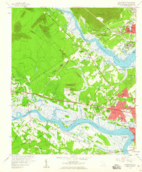
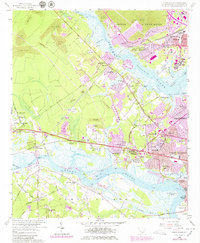
1958 Map of Johns Island
USGS Topo · Published 1959About this map
Drayton Hall and the historic Ashley River corridor anchor this late 1950s survey of the Lowcountry landscape west of Charleston. The map reveals an area in transition, where legacy estates and landmarks like Fort Bull sit alongside emerging mid-century residential pockets such as Wando Woods and Stono Park. The industrial footprint of the era is evident in the numerous Strip Mine operations scattered throughout the northern woods and the presence of the U S Department of Agriculture Experiment Farm.
Find a feature on this map
79 named features on this map. Tap any name to fly to it.
Don’t see what you’re looking for? This feature index may not catch every label — zoom into the map to look around manually.
Map Details
Editions of this 1958 Johns Island Map
5 editions found
Other maps of this area

1919 · Ladson
USGS Topo · 1:21,120

1919 · Johns Island
USGS Topo · 1:21,120

1919 · Wadmelaw Island
USGS Topo · 1:62,500

1919 · Melgrove
USGS Topo · 1:21,120

1919 · Charleston
USGS Topo · 1:21,120

1919 · James Island
USGS Topo · 1:21,120

1919 · Legareville
USGS Topo · 1:21,120

1920 · Ravenels
USGS Topo · 1:62,500

1940 · Melgrove
USGS Topo · 1:24,000

1943 · Legareville
USGS Topo · 1:24,000