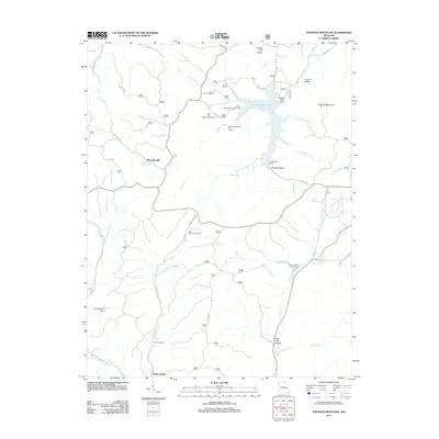
2011 Map of Johnson Mountain
USGS Topo · Published 2011About this map
Council Bluff Lake serves as a central landmark in this 2011 record of the Iron County landscape, where the waters are contained by the Council Bluff Dam. The surrounding terrain is defined by the elevation of Johnson Mountain and the deep cuts of Guyser Hollow and Peter Cave Hollow. Recreational infrastructure is evident through the Wild Boar Ridge Campground and multiple access points like the Wild Boar Hollow Boat Launch.
Find a feature on this map
41 named features on this map. Tap any name to fly to it.
Don’t see what you’re looking for? This feature index may not catch every label — zoom into the map to look around manually.
Map Details
Editions of this 2011 Johnson Mountain Map
This is the sole edition of this map. No revisions or reprints were ever made.
Other maps of this area

1906 · Potosi
USGS Topo · 1:62,500

1924 · Edgehill
USGS Topo · 1:62,500

1926 · Edgehill
USGS Topo · 1:62,500

1943 · Berryman
USGS Topo · 1:62,500

1943 · Boss
USGS Topo · 1:62,500

1945 · Berryman
USGS Topo · 1:62,500

1946 · Boss
USGS Topo · 1:62,500

1949 · Rolla
USGS Topo · 1:250,000

1953 · Rolla
USGS Topo · 1:250,000

1954 · Rolla
USGS Topo · 1:250,000