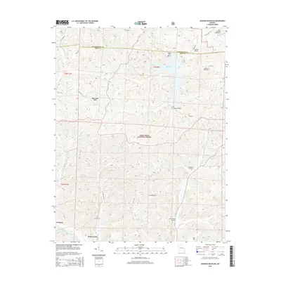
2015 Map of Johnson Mountain
USGS Topo · Published 2015About this map
Maxwells Mill and the headwaters of the Big River define this corner of the Mark Twain National Forest along the border of Iron and Washington counties. The landscape is characterized by the high peaks of the Saint Francois Mountains, including Johnson Mountain and Bell Mtn, which rise above a network of hollows and creeks. In the north, Council Bluff Lake provides a focal point near Council Bluffs and Chapel Hill Beach, while the southern reaches of the map track the rural settlements of Redmondville and Goodland. For genealogists and local historians, the inclusion of Terry Cemetery and Rencehausen Cemetery offers precise locations for family research. The drainage patterns of the Middle Fork Black River and various tributaries like Kaolin Cr and Ottery Cr illustrate the complex hydrography of the Missouri Ozarks.
Find a feature on this map
43 named features on this map. Tap any name to fly to it.
Don’t see what you’re looking for? This feature index may not catch every label — zoom into the map to look around manually.
Map Details
Editions of this 2015 Johnson Mountain Map
This is the sole edition of this map. No revisions or reprints were ever made.
Other maps of this area

1906 · Potosi
USGS Topo · 1:62,500

1924 · Edgehill
USGS Topo · 1:62,500

1926 · Edgehill
USGS Topo · 1:62,500

1943 · Berryman
USGS Topo · 1:62,500

1943 · Boss
USGS Topo · 1:62,500

1945 · Berryman
USGS Topo · 1:62,500

1946 · Boss
USGS Topo · 1:62,500

1949 · Rolla
USGS Topo · 1:250,000

1953 · Rolla
USGS Topo · 1:250,000

1954 · Rolla
USGS Topo · 1:250,000