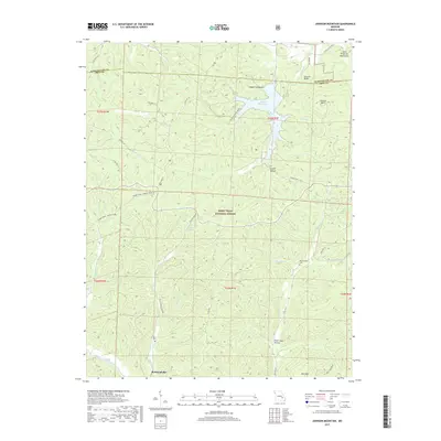
2017 Map of Johnson Mountain
USGS Topo · Published 2017About this map
Council Bluffs Lake sits at the heart of this Missouri landscape, surrounded by the peaks of the Saint Francois Mountains. This 2017 survey details a region where water and topography define the local geography, from the Big River winding through the center to the high elevations of Johnson Mtn and Bell Mtn. The small settlement of Redmondville stands near the southern boundary, while the surrounding Mark Twain National Forest preserves a network of drainages including Ottery Cr and Clayton Cr. Local heritage is preserved in the locations of Rencehausen Cem and Terry Cem, offering points of interest for genealogists. The map also traces the Ozark Trail - Middle Fork, illustrating how recreation and conservation have shaped the contemporary use of this land along the Washington and Iron county line.
Find a feature on this map
46 named features on this map. Tap any name to fly to it.
Don’t see what you’re looking for? This feature index may not catch every label — zoom into the map to look around manually.
Map Details
Editions of this 2017 Johnson Mountain Map
This is the sole edition of this map. No revisions or reprints were ever made.
Other maps of this area

1906 · Potosi
USGS Topo · 1:62,500

1924 · Edgehill
USGS Topo · 1:62,500

1926 · Edgehill
USGS Topo · 1:62,500

1943 · Berryman
USGS Topo · 1:62,500

1943 · Boss
USGS Topo · 1:62,500

1945 · Berryman
USGS Topo · 1:62,500

1946 · Boss
USGS Topo · 1:62,500

1949 · Rolla
USGS Topo · 1:250,000

1953 · Rolla
USGS Topo · 1:250,000

1954 · Rolla
USGS Topo · 1:250,000