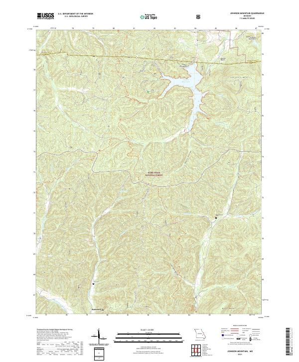
2021 Map of Johnson Mountain
USGS Topo · Published 2021About this map
Mark Twain National Forest dominates this section of the Saint Francois Mountains, where the headwaters of the Big River and the Middle Fork Black River carve through a heavily dissected landscape. The presence of Council Bluff Lake and its associated Chapel Hill Beach marks a significant recreational hub within the forest, situated near the dramatic heights of Council Bluffs. Small-scale human presence is concentrated in the south at Redmondville, while the rest of the terrain is defined by family-named hollows and peaks.
Find a feature on this map
37 named features on this map. Tap any name to fly to it.
Don’t see what you’re looking for? This feature index may not catch every label — zoom into the map to look around manually.
Map Details
Editions of this 2021 Johnson Mountain Map
This is the sole edition of this map. No revisions or reprints were ever made.
Other maps of this area

1906 · Potosi
USGS Topo · 1:62,500

1924 · Edgehill
USGS Topo · 1:62,500

1926 · Edgehill
USGS Topo · 1:62,500

1943 · Berryman
USGS Topo · 1:62,500

1943 · Boss
USGS Topo · 1:62,500

1945 · Berryman
USGS Topo · 1:62,500

1946 · Boss
USGS Topo · 1:62,500

1949 · Rolla
USGS Topo · 1:250,000

1953 · Rolla
USGS Topo · 1:250,000

1954 · Rolla
USGS Topo · 1:250,000