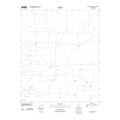
2010 Map of Johnson Ranch
USGS Topo · Published 2010About this map
Johnson Ranch serves as the central landmark for this high-plains landscape in southeastern New Mexico, where the infrastructure of cattle ranching is the dominant human imprint. The terrain is defined by the Simanola Valley and the Four Lakes Area, containing several distinct basins including North Lake, East Lake, and Middle Lake. While surface water appears limited to these depressions, a extensive network of named windmills reveals the critical reliance on groundwater for the region's agricultural survival. Many of these features carry identifiers like Lucky Windmill, X Four Windmill, and Drill Hole Sand Windmill, which often correspond to specific ranching operations or localized landmarks. Traversing this open country is County Rd-165, the primary artery connecting the ranch to the broader road network of Lea County.
Find a feature on this map
17 named features on this map. Tap any name to fly to it.
Don’t see what you’re looking for? This feature index may not catch every label — zoom into the map to look around manually.
Map Details
Editions of this 2010 Johnson Ranch Map
This is the sole edition of this map. No revisions or reprints were ever made.
Other maps of this area

1954 · Brownfield
USGS Topo · 1:250,000

1958 · Brownfield
USGS Topo · 1:250,000

1961 · Johnson Ranch
USGS Topo · 1:24,000

1962 · Brownfield
USGS Topo · 1:250,000

1970 · Johnson Ranch
USGS Topo · 1:24,000

1970 · Simanola Valley
USGS Topo · 1:24,000

1970 · Ranger Lake
USGS Topo · 1:24,000

1970 · Tatum North
USGS Topo · 1:24,000

1972 · Milnesand SW
USGS Topo · 1:24,000

1972 · Crossroads
USGS Topo · 1:24,000