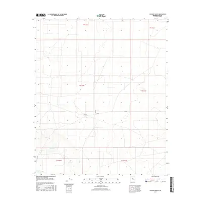
2017 Map of Johnson Ranch
USGS Topo · Published 2017About this map
Johnson Ranch sits at the center of this 2017 study of the Llano Estacado in Lea County, illustrating the sparse settlement and large-scale land management typical of the High Plains. The landscape is defined by its subtle depressions and terminal basins, most notably the Four Lakes region in the southwestern corner. This area includes North Lake, East Lake, and Middle Lake, which represent critical water sources in an otherwise arid ranching environment. Transportation is limited to a few arterial routes like Co Rd 165 and Peveler Dr, highlighting the isolation of these remote homesteads. The map serves as a clear record of the Public Land Survey System divisions, with the township and range lines of T9S through T11S meticulously delineated across the open range.
Find a feature on this map
13 named features on this map. Tap any name to fly to it.
Don’t see what you’re looking for? This feature index may not catch every label — zoom into the map to look around manually.
Map Details
Editions of this 2017 Johnson Ranch Map
This is the sole edition of this map. No revisions or reprints were ever made.
Other maps of this area

1954 · Brownfield
USGS Topo · 1:250,000

1958 · Brownfield
USGS Topo · 1:250,000

1961 · Johnson Ranch
USGS Topo · 1:24,000

1962 · Brownfield
USGS Topo · 1:250,000

1970 · Johnson Ranch
USGS Topo · 1:24,000

1970 · Simanola Valley
USGS Topo · 1:24,000

1970 · Ranger Lake
USGS Topo · 1:24,000

1970 · Tatum North
USGS Topo · 1:24,000

1972 · Milnesand SW
USGS Topo · 1:24,000

1972 · Crossroads
USGS Topo · 1:24,000