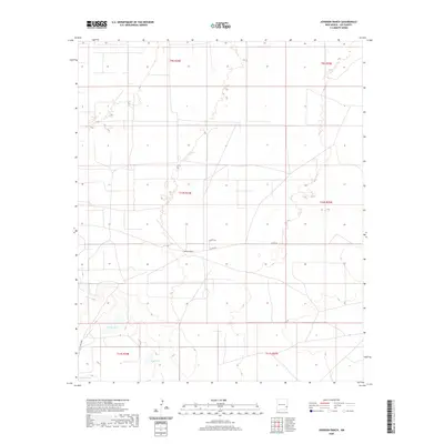
2020 Map of Johnson Ranch
USGS Topo · Published 2020About this map
Johnson Ranch sits at the center of this Lea County landscape, representing the enduring ranching tradition of the High Plains. The terrain is defined by its subtle depressions and intermittent water features, most notably North Lake, East Lake, and Middle Lake. These natural basins suggest the importance of water management and natural drainage in a region dominated by wide-open ranch land. The transportation network is sparse and functional, centered on routes such as Peveler Dr and Co Rd 165, which connect the headquarters of the ranch to the broader county infrastructure. A specialized road, T161 Four Lakes, skirts the western edge, providing access to the series of depressions and lake beds that likely serve as critical landmarks for local land use and navigation in this corner of New Mexico.
Find a feature on this map
13 named features on this map. Tap any name to fly to it.
Don’t see what you’re looking for? This feature index may not catch every label — zoom into the map to look around manually.
Map Details
Editions of this 2020 Johnson Ranch Map
This is the sole edition of this map. No revisions or reprints were ever made.
Other maps of this area

1954 · Brownfield
USGS Topo · 1:250,000

1958 · Brownfield
USGS Topo · 1:250,000

1961 · Johnson Ranch
USGS Topo · 1:24,000

1962 · Brownfield
USGS Topo · 1:250,000

1970 · Johnson Ranch
USGS Topo · 1:24,000

1970 · Simanola Valley
USGS Topo · 1:24,000

1970 · Ranger Lake
USGS Topo · 1:24,000

1970 · Tatum North
USGS Topo · 1:24,000

1972 · Milnesand SW
USGS Topo · 1:24,000

1972 · Crossroads
USGS Topo · 1:24,000