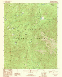
1986 Map of Johnsondale
USGS Topo · Published 1986About this map
The mountain community of Johnsondale serves as the focal point of this mid-1980s survey, situated within the dense woodlands of Sequoia National Forest. The map documents a landscape defined by significant groves of Giant Sequoias, including Packsaddle Grove, Redwood Grove, and Starvation Creek Grove. These protected stands are interspersed with numerous high-altitude meadows such as Horse Meadow and Long Meadow, which have historically supported local grazing and forestry operations.
Find a feature on this map
54 named features on this map. Tap any name to fly to it.
Don’t see what you’re looking for? This feature index may not catch every label — zoom into the map to look around manually.
Map Details
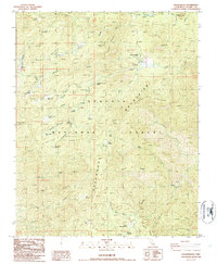
Editions of this 1986 Johnsondale Map
2 editions found
Other maps of this area

1904 · Kaweah
USGS Topo · 1:125,000

1905 · Olancha
USGS Topo · 1:125,000

1905 · Fairview
USGS Topo · 1:24,000

1906 · Kernville
USGS Topo · 1:125,000

1907 · Olancha
USGS Topo · 1:125,000

1908 · Kernville
USGS Topo · 1:125,000

1909 · Kaweah
USGS Topo · 1:125,000
1918 · Fairview
USGS Topo · 1:31,680

1936 · Tobias Peak
USGS Topo · 1:125,000

1937 · Kaweah
USGS Topo · 1:125,000