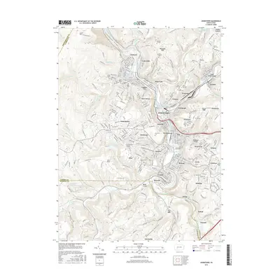
2016 Map of Johnstown
USGS Topo · Published 2016About this map
The Conemaugh Gorge carves a dramatic passage through Laurel Mountain as the Conemaugh River meets the industrial heart of this region. The urban landscape of Johnstown is a dense network of neighborhoods including Kernville, Moxham, and Woodvale, situated at the confluence with the Stonycreek River. This modern survey reveals the lasting imprint of the city's ethnic and religious history, evidenced by a high concentration of parish cemeteries such as Saint Stephens Cem, Saint Marys Cem, and Saints Peter and Paul Cem. Higher elevations like Tire Hill and Pleasant Hill overlook the river valleys where the Little Conemaugh River and Hinckston Run define the eastern approaches. Institutional landmarks like the Commonwealth Technical Institute and the Cambria Rowe Business College reflect the community's evolution into a modern center for education and business services within Cambria County.
Find a feature on this map
89 named features on this map. Tap any name to fly to it.
Don’t see what you’re looking for? This feature index may not catch every label — zoom into the map to look around manually.
Map Details
Editions of this 2016 Johnstown Map
This is the sole edition of this map. No revisions or reprints were ever made.
Other maps of this area

1904 · Johnstown
USGS Topo · 1:62,500

1907 · Johnstown
USGS Topo · 1:62,500

1913 · Somerset
USGS Topo · 1:62,500

1914 · Windber
USGS Topo · 1:62,500

1915 · Somerset
USGS Topo · 1:62,500

1916 · Windber
USGS Topo · 1:62,500

1920 · New Florence
USGS Topo · 1:62,500

1921 · New Florence
USGS Topo · 1:48,000

1922 · New Florence
USGS Topo · 1:62,500

1944 · Somerset
USGS Topo · 1:62,500