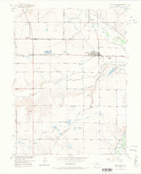
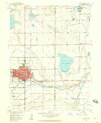
1950 Map of Johnstown
USGS Topo · Published 1970About this map
Johnstown serves as the central hub of this agricultural landscape at the mid-century, situated at the junction of the Great Western RR and the Union Pacific RR. The map captures a complex irrigation network essential to the Colorado High Plains, featuring extensive water systems such as the Handy Ditch, Home Supply Ditch, and Hillsboro Ditch. These waterways support a series of rural communities and rail stops including Buda, Pulliam, and Bunyan.
Find a feature on this map
38 named features on this map. Tap any name to fly to it.
Don’t see what you’re looking for? This feature index may not catch every label — zoom into the map to look around manually.
Map Details
Editions of this 1950 Johnstown Map
5 editions found

Other maps of this area

1902 · Greeley
USGS Topo · 1:125,000

1904 · Niwot
USGS Topo · 1:62,500

1906 · Loveland
USGS Topo · 1:62,500

1908 · Loveland
USGS Topo · 1:62,500

1949 · Gowanda
USGS Topo · 1:24,000

1949 · Platteville
USGS Topo · 1:24,000

1950 · Gowanda
USGS Topo · 1:24,000

1950 · Platteville
USGS Topo · 1:24,000

1950 · Windsor
USGS Topo · 1:24,000
1950 · Longmont
USGS Topo · 1:24,000