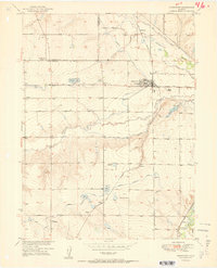
1951 Map of Johnstown
USGS Topo · Published 1951About this map
The agricultural landscape of the Larimer and Weld county border is defined by an intricate network of irrigation canals and the sugar beet industry. The Great Western railroad serves as the primary artery for transportation, linking small rail stops and settlements like Buda, Pulliam, and Bunyan. Central to the region is Johnstown, where the local economy revolves around water management and bulk grain storage, evidenced by the Johnstown Res and the Walker Elevator further south near Walker. Rural life is anchored by community landmarks such as the Twin Mounds School and Erkenbeck Sch 1, alongside the quiet grounds of the Elwell Cem. The terrain is fed by the Big Thompson River and Little Thompson River, diverted through numerous man-made channels like the Hillsboro Ditch and Great Western Ditch to sustain the high plains farmland.
Find a feature on this map
38 named features on this map. Tap any name to fly to it.
Don’t see what you’re looking for? This feature index may not catch every label — zoom into the map to look around manually.
Map Details
Editions of this 1951 Johnstown Map
2 editions found
Other maps of this area

1902 · Greeley
USGS Topo · 1:125,000

1904 · Niwot
USGS Topo · 1:62,500

1906 · Loveland
USGS Topo · 1:62,500

1908 · Loveland
USGS Topo · 1:62,500

1949 · Gowanda
USGS Topo · 1:24,000

1949 · Platteville
USGS Topo · 1:24,000

1950 · Gowanda
USGS Topo · 1:24,000

1950 · Platteville
USGS Topo · 1:24,000

1950 · Windsor
USGS Topo · 1:24,000
1950 · Longmont
USGS Topo · 1:24,000