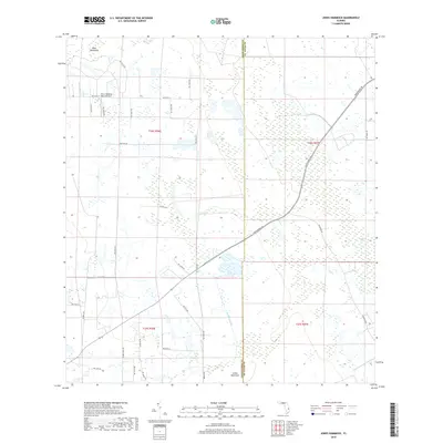
2018 Map of Jones Hammock
USGS Topo · Published 2018About this map
Jones Hammock sits along the southern border of this interior Florida landscape, where the boundary between Okeechobee County and St. Lucie County cuts through a region defined by agricultural development and drainage networks. The map shows a transition from natural hammocks like Dark Hammock to more structured land use, notably indicated by the Citrus Hedging Ranch Airport in the northwest. Movement through this area centers on Okeechobee Rd, which diagonally bisects the terrain. Water management is a primary feature of the landscape, seen in the winding paths of Nubbin Slough and Cypress Creek, which flow through a grid of section lines and rural roads. The concentration of groves and ranching infrastructure suggests the economic focus of the region during this era of modern land survey.
Find a feature on this map
37 named features on this map. Tap any name to fly to it.
Don’t see what you’re looking for? This feature index may not catch every label — zoom into the map to look around manually.
Map Details
Editions of this 2018 Jones Hammock Map
This is the sole edition of this map. No revisions or reprints were ever made.
Other maps of this area

1952 · Okeechobee
USGS Topo · 1:24,000

1953 · Okeechobee 1 SE
USGS Topo · 1:24,000

1953 · Okeechobee 4 NE
USGS Topo · 1:24,000

1953 · Okeechobee 4 NW
USGS Topo · 1:24,000

1953 · Okeechobee 1 SW
USGS Topo · 1:24,000

1953 · Taylor Creek SE
USGS Topo · 1:24,000

1953 · Taylor Creek NE
USGS Topo · 1:24,000

1953 · Okeechobee 1 NE
USGS Topo · 1:24,000

1953 · Okeechobee 1 NW
USGS Topo · 1:24,000

1956 · Fort Pierce
USGS Topo · 1:250,000