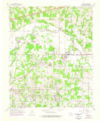
1955 Map of Jones
USGS Topo · Published 1976About this map
The North Canadian River meanders across this landscape, its path reinforced by a prominent levee system as it passes the settlement of Jones. This area of Oklahoma County showcases the mid-century transition from rural farmsteads and riverside sandpits to organized suburban growth. Transportation is a defining characteristic here, with the Turner Toll Road Turnpike cutting through the northern section and the San Francisco St Louis railroad connecting the local economy. Social and community life are well-documented through landmarks like Rose Hill Sch, Salem Ch, and Mt Moriah Ch, alongside several family and fraternal burial grounds including Chitwood Cem and the Odd Fellows Cem. The presence of Green Pastures and Dunjee High Sch provides specific locational detail for researchers tracing the development of residential and educational centers during this era of Oklahoma's history.
Find a feature on this map
35 named features on this map. Tap any name to fly to it.
Don’t see what you’re looking for? This feature index may not catch every label — zoom into the map to look around manually.
Map Details
Editions of this 1955 Jones Map
4 editions found
Other maps of this area

1892 · Moore
USGS Topo · 1:62,500

1892 · Edmond
USGS Topo · 1:62,500

1898 · Purcell
USGS Topo · 1:125,000

1909 · Luther
USGS Topo · 1:62,500

1930 · McLoud
USGS Topo · 1:62,500

1934 · Crutcho Creek
USGS Topo · 1:24,000

1934 · Moore
USGS Topo · 1:62,500

1935 · Spencer
USGS Topo · 1:24,000

1935 · Edmond
USGS Topo · 1:48,000

1938 · Moore
USGS Topo · 1:62,500