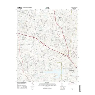
2017 Map of Jonesboro
USGS Topo · Published 2017About this map
Jonesboro and the expanding suburbs of southern Atlanta are documented in this detailed 21st-century record. The area is defined by its complex water systems, with numerous man-made lakes and tributaries such as Big Cottonindian Cr and Panther Cr carving through the residential landscape. Significant educational and military landmarks are prominent, including the campus of Clayton State Univ and the established grounds of Fort Gillem.
Find a feature on this map
70 named features on this map. Tap any name to fly to it.
Don’t see what you’re looking for? This feature index may not catch every label — zoom into the map to look around manually.
Map Details
Editions of this 2017 Jonesboro Map
This is the sole edition of this map. No revisions or reprints were ever made.
Other maps of this area

1888 · Atlanta
USGS Topo · 1:125,000

1890 · Atlanta
USGS Topo · 1:125,000

1892 · Atlanta
USGS Topo · 1:125,000

1895 · Atlanta
USGS Topo · 1:125,000

1953 · Atlanta
USGS Topo · 1:250,000
1954 · Conley
USGS Topo · 1:24,000
1954 · Jonesboro
USGS Topo · 1:24,000
1954 · Riverdale
USGS Topo · 1:24,000
1954 · East Point
USGS Topo · 1:24,000
1956 · Redan
USGS Topo · 1:24,000