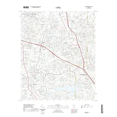
2020 Map of Jonesboro
USGS Topo · Published 2020About this map
Jonesboro and the expanding southern suburbs of Atlanta are shown here in modern detail, illustrating a landscape where residential growth meets institutional and natural landmarks. The map traces the corridor between Forest Park and Stockbridge, highlighting the complex hydrology of the South Piedmont, including the sprawling waters of Lake Jodeco, Lake Tara, and the course of Big Cotton Indian Cr. For the local historian, the map identifies several significant burial grounds, from the Confederate Cem and Jonesboro City Cem to the smaller The Rock Cem near Rex.
Find a feature on this map
73 named features on this map. Tap any name to fly to it.
Don’t see what you’re looking for? This feature index may not catch every label — zoom into the map to look around manually.
Map Details
Editions of this 2020 Jonesboro Map
This is the sole edition of this map. No revisions or reprints were ever made.
Other maps of this area

1888 · Atlanta
USGS Topo · 1:125,000

1890 · Atlanta
USGS Topo · 1:125,000

1892 · Atlanta
USGS Topo · 1:125,000

1895 · Atlanta
USGS Topo · 1:125,000

1953 · Atlanta
USGS Topo · 1:250,000

1954 · Conley
USGS Topo · 1:24,000

1954 · Jonesboro
USGS Topo · 1:24,000

1954 · Riverdale
USGS Topo · 1:24,000

1954 · East Point
USGS Topo · 1:24,000

1956 · Redan
USGS Topo · 1:24,000