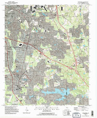
1993 Map of Jonesboro
USGS Topo · Published 1995About this map
Fort Gillem Military Reservation anchors the northern boundary of this suburban landscape south of Atlanta, where the transition from industrial and military utility to residential expansion is evident. The region is defined by a dense network of schools and civic institutions, including Clayton State College and several campuses like Jonesboro High Sch and Mt Zion High Sch. Large-scale commercial development is centered at the Southlake Mall Shopping Center, while the southern portion of the quadrangle retains a more hydrological character around the expansive Spivey Lake and Jodeco Lake.
Find a feature on this map
85 named features on this map. Tap any name to fly to it.
Don’t see what you’re looking for? This feature index may not catch every label — zoom into the map to look around manually.
Map Details
Editions of this 1993 Jonesboro Map
This is the sole edition of this map. No revisions or reprints were ever made.
Other maps of this area

1888 · Atlanta
USGS Topo · 1:125,000

1890 · Atlanta
USGS Topo · 1:125,000

1892 · Atlanta
USGS Topo · 1:125,000

1895 · Atlanta
USGS Topo · 1:125,000

1953 · Atlanta
USGS Topo · 1:250,000

1954 · Conley
USGS Topo · 1:24,000

1954 · Jonesboro
USGS Topo · 1:24,000

1954 · Riverdale
USGS Topo · 1:24,000

1954 · East Point
USGS Topo · 1:24,000

1956 · Redan
USGS Topo · 1:24,000