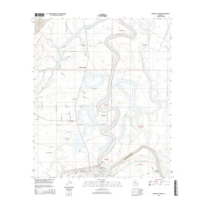
2015 Map of Jonesville North
USGS Topo · Published 2015About this map
The confluence of the Ouachita River, Tensas River, and Little River defines this landscape in Catahoula Parish, where they merge to form the Black River. This complex waterway system, characterized by dramatic meanders like Meyers Bend, has long influenced the placement of local settlements and transport routes. Jonesville sits at this strategic river junction, with the nearby communities of Trinity and Quaid positioned along the banks.
Find a feature on this map
74 named features on this map. Tap any name to fly to it.
Don’t see what you’re looking for? This feature index may not catch every label — zoom into the map to look around manually.
Map Details
Editions of this 2015 Jonesville North Map
This is the sole edition of this map. No revisions or reprints were ever made.
Other maps of this area

1939 · Red Gum
USGS Topo · 1:62,500

1941 · Manifest
USGS Topo · 1:62,500

1941 · Sicily Island
USGS Topo · 1:62,500

1941 · Harrisonburg
USGS Topo · 1:62,500

1953 · Natchez
USGS Topo · 1:250,000

1956 · Natchez
USGS Topo · 1:250,000

1957 · Sicily Island
USGS Topo · 1:62,500

1959 · Natchez
USGS Topo · 1:250,000

1959 · Harrisonburg
USGS Topo · 1:62,500

1960 · Jonesville
USGS Topo · 1:62,500