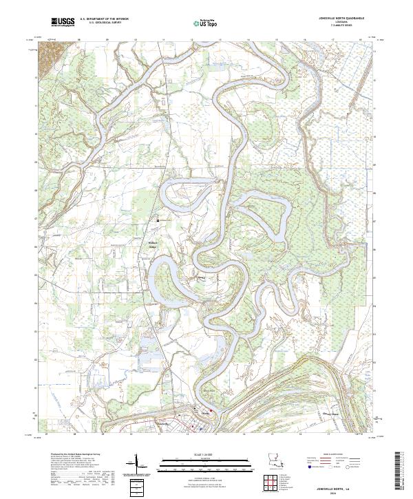
2024 Map of Jonesville North
USGS Topo · Published 2024About this map
The Ouachita River dominates this delta landscape, winding in deep meanders across the border of Catahoula Parish and Concordia Parish. Near the southern edge of the sheet, four major water bodies—the Little River, the Tensas River, and the Ouachita River—converge to form the Black River. This hydrographic junction is the heart of the region's geography, anchoring the settlements of Jonesville and Trinity, the latter located just north of Tensas Point.
Find a feature on this map
94 named features on this map. Tap any name to fly to it.
Don’t see what you’re looking for? This feature index may not catch every label — zoom into the map to look around manually.
Map Details
Editions of this 2024 Jonesville North Map
This is the sole edition of this map. No revisions or reprints were ever made.
Other maps of this area

1939 · Red Gum
USGS Topo · 1:62,500

1941 · Manifest
USGS Topo · 1:62,500

1941 · Sicily Island
USGS Topo · 1:62,500

1941 · Harrisonburg
USGS Topo · 1:62,500

1953 · Natchez
USGS Topo · 1:250,000

1956 · Natchez
USGS Topo · 1:250,000

1957 · Sicily Island
USGS Topo · 1:62,500

1959 · Natchez
USGS Topo · 1:250,000

1959 · Harrisonburg
USGS Topo · 1:62,500

1960 · Jonesville
USGS Topo · 1:62,500