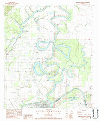
1983 Map of Jonesville North
USGS Topo · Published 1983About this map
The confluence of the Little River, Ouachita River, and Tensas River anchors this landscape in eastern Catahoula Parish. In the early 1980s, the area around Jonesville and Trinity reflects a complex relationship between delta hydrology and industrial extraction. The meandering river courses are flanked by numerous oxbow lakes and brakes, such as Tew Lake and Mean Lake, many of which sit within active petroleum production areas like the Tew Lake Oil Field and Mean Lake Oil Field. Local life is well-documented through a network of rural landmarks, including the McFarlen Cem and several community houses of worship such as Calvary Ch and Wallace Ridge Ch. Cultural and recreational sites like Midland State Park and the Brickyard near the Concordia Parish line further illustrate the varied land use of this river-bottom region.
Find a feature on this map
50 named features on this map. Tap any name to fly to it.
Don’t see what you’re looking for? This feature index may not catch every label — zoom into the map to look around manually.
Map Details
Editions of this 1983 Jonesville North Map
This is the sole edition of this map. No revisions or reprints were ever made.
Other maps of this area

1939 · Red Gum
USGS Topo · 1:62,500

1941 · Manifest
USGS Topo · 1:62,500

1941 · Sicily Island
USGS Topo · 1:62,500

1941 · Harrisonburg
USGS Topo · 1:62,500

1953 · Natchez
USGS Topo · 1:250,000

1956 · Natchez
USGS Topo · 1:250,000

1957 · Sicily Island
USGS Topo · 1:62,500

1959 · Natchez
USGS Topo · 1:250,000

1959 · Harrisonburg
USGS Topo · 1:62,500

1960 · Jonesville
USGS Topo · 1:62,500