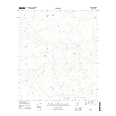
2016 Map of Joppa
USGS Topo · Published 2016About this map
The N Fork San Gabriel River and the Russell Fork San Gabriel River carve through this central Texas landscape, defining the topography of Burnet County near the community of Joppa. At the southern edge of the survey, the city of Bertram serves as a local hub where Bear Cr flows toward the east. This 2016 data reflects a region where traditional ranching and rural cemetery sites, such as Strickling Cem and Shady Grove Cem, exist alongside modern private aviation facilities like Skotz Airfield and Griffin Airport. The drainage patterns are intricate, with seasonal waterways like Pool Br and Olive Br feeding into the larger river forks. Named terrain features like Stone Quarry Hollow and Postoak Hollow suggest the geological character of the northern hills.
Find a feature on this map
49 named features on this map. Tap any name to fly to it.
Don’t see what you’re looking for? This feature index may not catch every label — zoom into the map to look around manually.
Map Details
Editions of this 2016 Joppa Map
This is the sole edition of this map. No revisions or reprints were ever made.
Other maps of this area

1887 · Burnet
USGS Topo · 1:125,000

1893 · Georgetown
USGS Topo · 1:125,000

1893 · Burnet
USGS Topo · 1:125,000

1903 · Burnet
USGS Topo · 1:125,000

1909 · Burnet
USGS Topo · 1:125,000

1932 · Bertram
USGS Topo · 1:62,500

1954 · Llano
USGS Topo · 1:250,000

1954 · Austin
USGS Topo · 1:250,000

1955 · Llano
USGS Topo · 1:250,000

1956 · Llano
USGS Topo · 1:250,000