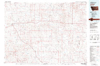
1983 Map of Jordan
USGS Topo · Published 1983About this map
Jordan stands as the primary hub of this eastern Montana landscape, situated at the junction of Highway 200 and Highway 59. The terrain is defined by an intricate network of drainages that feed into Big Dry Creek and Little Dry Creek, revealing the high plains topography of Garfield County in the early 1980s. To the northwest, the map captures a portion of the Charles M Russell National Wildlife Range, illustrating the vast transition from ranchlands to protected breaks.
Find a feature on this map
73 named features on this map. Tap any name to fly to it.
Don’t see what you’re looking for? This feature index may not catch every label — zoom into the map to look around manually.
Map Details
Editions of this 1983 Jordan Map
This is the sole edition of this map. No revisions or reprints were ever made.
Other maps of this area

1953 · Miles City
USGS Topo · 1:250,000

1954 · Jordan
USGS Topo · 1:250,000

1954 · Forsyth
USGS Topo · 1:250,000

1954 · Glendive
USGS Topo · 1:250,000

1956 · Jordan
USGS Topo · 1:250,000

1957 · Miles City
USGS Topo · 1:250,000

1957 · Glendive
USGS Topo · 1:250,000

1957 · Forsyth
USGS Topo · 1:250,000

1958 · Miles City
USGS Topo · 1:250,000

1958 · Jordan
USGS Topo · 1:250,000