
2013 Map of Jordan West
USGS Topo · Published 2013About this map
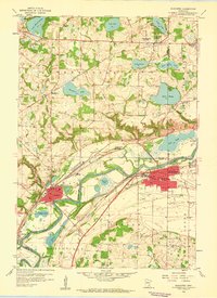
The Minnesota River carves a wide alluvial path through the center of this landscape, separating the village of East Union on the northern bluffs from the town of Jordan to the southeast. This 2013 topographic data captures a region defined by its glacial history, evidenced by a dense concentration of wetlands and water bodies such as Louisville Swamp, Kelly Lake, and Johnson Lake. The map reveals a strong Scandinavian heritage through local landmarks, including the Augustana Cem, Swedish Lutheran Cem, and Swedish Methodist Cem. Aviation and recreation also shape the modern geography here, with the Stocker Private Airport, Merrill L Harris Field Airport, and the Scott County Fairgrounds occupying significant acreage. The natural descent of the river is marked by the Carver Rapids, while the local economy and transport are traced along Johnson Memorial Dr and the older Old Highway 169 Blvd.
Find a feature on this map
84 named features on this map. Tap any name to fly to it.
Don’t see what you’re looking for? This feature index may not catch every label — zoom into the map to look around manually.
Map Details
Editions of this 2013 Jordan West Map
This is the sole edition of this map. No revisions or reprints were ever made.
Other maps of this area

1905 · Minnetonka
USGS Topo · 1:62,500

1907 · Minnetonka
USGS Topo · 1:62,500

1953 · Saint Paul
USGS Topo · 1:250,000

1957 · Belle Plaine
USGS Topo · 1:62,500

1957 · Waconia
USGS Topo · 1:62,500

1957 · New Prague
USGS Topo · 1:62,500

1958 · Victoria
USGS Topo · 1:24,000

1958 · Lake Minnetonka
USGS Topo · 1:62,500
1958 · Shakopee
USGS Topo · 1:24,000

1959 · Saint Paul
USGS Topo · 1:250,000