2022 Map of Jordan West
USGS Topo · Published 2022About this map
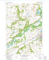
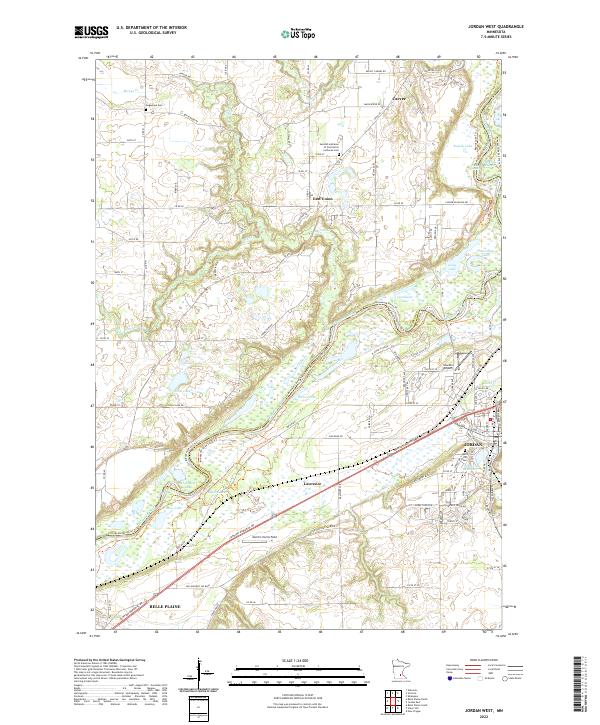
The Minnesota River corridor defines this landscape, separating Carver Co from Scott Co as it winds through a complex of backwaters and sloughs. This 2022 survey documents the river's significant alluvial plain, featuring numerous named water bodies including Rapids Lake, Horseshoe Lake, and Johnson Slough. The settlement of Jordan sits at the eastern edge of the quadrangle, where Sand Cr Reservoir and Spirit Hill Cem are situated on the rising ground away from the river bottoms.
Find a feature on this map
109 named features on this map. Tap any name to fly to it.
Don’t see what you’re looking for? This feature index may not catch every label — zoom into the map to look around manually.
Map Details
Editions of this 2022 Jordan West Map
This is the sole edition of this map. No revisions or reprints were ever made.
Historical Maps of Valley Green Mobile Home Park Through Time
6 maps found