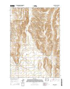
2014 Map of Joseph NW
USGS Topo · Published 2014About this map
Wallowa River and its complex network of irrigation channels define the agricultural character of this Wallowa County landscape. The map reveals an intricate system of water management including Farmers Ditch, Granger Ditch, Big Bend Ditch, and the Wrenn Dobbin Ditch, which redirect water across the valley floor. These human-made features intersect with natural drainages like Swamp Cr and Prairie Cr, illustrating a long-standing reliance on water engineering to sustain the local ranching and farming economy.
Find a feature on this map
29 named features on this map. Tap any name to fly to it.
Don’t see what you’re looking for? This feature index may not catch every label — zoom into the map to look around manually.
Map Details
Editions of this 2014 Joseph NW Map
This is the sole edition of this map. No revisions or reprints were ever made.
Other maps of this area

1955 · Grangeville
USGS Topo · 1:250,000

1957 · Enterprise
USGS Topo · 1:62,500

1957 · Joseph
USGS Topo · 1:62,500

1957 · Sled Springs
USGS Topo · 1:62,500

1957 · Elk Mountain
USGS Topo · 1:62,500

1959 · Grangeville
USGS Topo · 1:250,000

1982 · Wallowa
USGS Topo · 1:100,000

1986 · Enterprise
USGS Topo · 1:100,000

1990 · Chief Joseph Mtn
USGS Topo · 1:24,000
1990 · Joseph
USGS Topo · 1:24,000