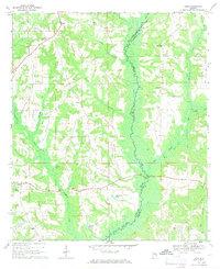
1968 Map of Josie
USGS Topo · Published 1971About this map
The Pea River serves as the primary geographical divider in this corner of Alabama, marking the boundary between Pike and Barbour counties. The landscape is defined by the heavy drainage of tributary systems including Buckhorn Creek and Connors Creek, which feed into the wider river valley. Scattered throughout these rural uplands are long-established community centers like Josie, Enon, and Shiloh, which serve as anchors for the local agricultural population.
Find a feature on this map
24 named features on this map. Tap any name to fly to it.
Don’t see what you’re looking for? This feature index may not catch every label — zoom into the map to look around manually.
Map Details
Editions of this 1968 Josie Map
2 editions found
Other maps of this area

1948 · Brundidge
USGS Topo · 1:62,500

1950 · Brundidge
USGS Topo · 1:62,500

1953 · Dothan
USGS Topo · 1:250,000

1954 · Dothan
USGS Topo · 1:250,000

1955 · Dothan
USGS Topo · 1:250,000

1960 · Brundidge
USGS Topo · 1:24,000

1962 · Brundidge
USGS Topo · 1:25,000

1968 · Perote
USGS Topo · 1:24,000

1968 · Louisville
USGS Topo · 1:24,000
1968 · Saco
USGS Topo · 1:24,000