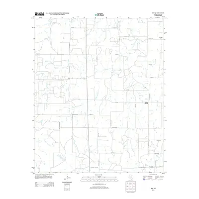
2012 Map of Joy
USGS Topo · Published 2012About this map
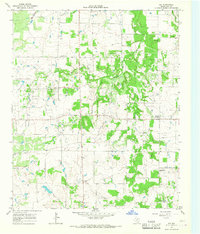
Joy and Buffalo Springs anchor this rural Clay County landscape, where the agricultural grid is deeply intertwined with the hydrologic network of the E Fork Little Wichita River. The region’s economic character is defined by the Joy Oil Field, reflecting the persistent role of energy production alongside ranching and farming. Local family histories are preserved at the Friendship Cem in the northeast and Pleasant Valley Cem to the south, connected by a web of named country roads such as Rock Church Rd and Old Joy Shannon Rd. The terrain is drained by several seasonal watercourses including Joy Cr, Lodge Cr, and Buffalo Cr, which feed into larger systems or small impoundments like Burns Lake. This survey captures a moment of modern rural continuity in North Texas, where the infrastructure of the oil industry exists in quiet proximity to long-standing cattle-country settlements.
Find a feature on this map
50 named features on this map. Tap any name to fly to it.
Don’t see what you’re looking for? This feature index may not catch every label — zoom into the map to look around manually.
Map Details
Editions of this 2012 Joy Map
This is the sole edition of this map. No revisions or reprints were ever made.
Other maps of this area

1954 · Wichita Falls
USGS Topo · 1:250,000

1958 · Wichita Falls
USGS Topo · 1:250,000

1962 · Antelope Creek NE
USGS Topo · 1:24,000

1963 · Deer Creek
USGS Topo · 1:24,000
1963 · Vashti
USGS Topo · 1:24,000
1964 · Newport
USGS Topo · 1:24,000

1964 · Antelope
USGS Topo · 1:24,000

1964 · Scotland SE
USGS Topo · 1:24,000
1964 · Postoak
USGS Topo · 1:24,000
1964 · Joy
USGS Topo · 1:24,000